Category:Usk Valley Walk
Jump to navigation
Jump to search
English: The Usk Valley Walk is a waymarked long distance footpath in south east Wales, from Caerleon to Brecon. (→Usk Valley Walk)

Long-distance footpath in south Wales | |||||
| Upload media | |||||
| Instance of |
| ||||
|---|---|---|---|---|---|
| Location |
| ||||
| Length |
| ||||
| |||||
Subcategories
This category has the following 2 subcategories, out of 2 total.
Media in category "Usk Valley Walk"
The following 86 files are in this category, out of 86 total.
-
 A rather pointless sign! (geograph 5572713).jpg 2,592 × 1,944; 1.4 MB
-
 A449 at Newbridge on Usk - geograph.org.uk - 1255636.jpg 426 × 640; 96 KB
-

-

-
 Bridleway near Ffawyddog - geograph.org.uk - 1323029.jpg 426 × 640; 97 KB
-
 Buckland Hall - geograph.org.uk - 1377823.jpg 640 × 426; 84 KB
-
 Bulmore Road - geograph.org.uk - 1758400.jpg 1,200 × 1,600; 465 KB
-
 Caerleon viewed from the east - geograph.org.uk - 1253864.jpg 640 × 426; 99 KB
-
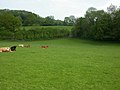
 Cattle and sheep above Aber village - geograph.org.uk - 1377855.jpg 640 × 426; 81 KB
-
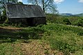
 Cefn Barn - geograph.org.uk - 1269728.jpg 640 × 426; 92 KB
-
 Coety Wood - geograph.org.uk - 1380073.jpg 640 × 426; 128 KB
-
 Crumbling pillbox in the Usk valley - geograph.org.uk - 1290466.jpg 640 × 426; 117 KB
-
 Disk plough on Cefn Hill - geograph.org.uk - 1269747.jpg 640 × 426; 99 KB
-
 Farm track to Pen-y-fedw - geograph.org.uk - 1324011.jpg 640 × 426; 108 KB
-
 Flood bank on the River Usk - geograph.org.uk - 1273668.jpg 640 × 426; 79 KB
-
 Footbridge at Llantrisant - geograph.org.uk - 1270506.jpg 640 × 426; 124 KB
-
 Footbridge over the River Caerfanell - geograph.org.uk - 1378228.jpg 640 × 426; 106 KB
-
 Grazing land near Bettws Newydd - geograph.org.uk - 1290486.jpg 640 × 426; 75 KB
-
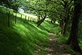
 Green lane - geograph.org.uk - 670822.jpg 640 × 480; 113 KB
-
-
 Green lane on Corn Hill - geograph.org.uk - 1270491.jpg 426 × 640; 142 KB
-
 Kissing gate on the Usk Valley Walk - geograph.org.uk - 1255639.jpg 426 × 640; 94 KB
-

-

-

-
 Old farm buildings near Ffawyddog - geograph.org.uk - 1323624.jpg 640 × 426; 115 KB
-
 Olway Brook-Nant Olwy - geograph.org.uk - 1273265.jpg 640 × 426; 92 KB
-
 Path through Coed Ffawyddog - geograph.org.uk - 1322364.jpg 426 × 640; 120 KB
-
 Pen Cerrig-calch and Table Mountain - geograph.org.uk - 1323042.jpg 640 × 426; 86 KB
-
-
 Pen-y-fedw - geograph.org.uk - 1323780.jpg 640 × 426; 89 KB
-
 Pen-y-fedw - geograph.org.uk - 1324009.jpg 640 × 426; 113 KB
-
 Pencelli and the Usk valley - geograph.org.uk - 1381197.jpg 640 × 426; 77 KB
-
 Pillbox near The Bryn - geograph.org.uk - 1287687.jpg 640 × 426; 95 KB
-
 Pillbox near The Bryn - geograph.org.uk - 1287699.jpg 640 × 426; 90 KB
-
 Pumping station at Llantrisant - geograph.org.uk - 1270511.jpg 640 × 426; 69 KB
-
 River Usk near Clytha Park - geograph.org.uk - 1286522.jpg 640 × 426; 78 KB
-
 River Usk near Llantrisant - geograph.org.uk - 1273053.jpg 640 × 426; 104 KB
-
 Ruin beside the Usk Valley Walk - geograph.org.uk - 1381195.jpg 640 × 426; 130 KB
-
 Sign on the Usk Valley Walk - geograph.org.uk - 1286711.jpg 426 × 640; 90 KB
-
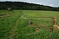
 Stile on the Usk Valley Walk - geograph.org.uk - 1377834.jpg 640 × 426; 114 KB
-

-
 Sugar Loaf viewed from Ffawyddog - geograph.org.uk - 1323035.jpg 426 × 640; 94 KB
-
 Talybont Reservoir - geograph.org.uk - 1377866.jpg 640 × 426; 95 KB
-
 Talybont Reservoir - geograph.org.uk - 1377872.jpg 640 × 426; 93 KB
-
 Tan-y-Lan Farm - geograph.org.uk - 1323690 (cropped).jpg 258 × 174; 20 KB
-
 Tan-y-Lan Farm - geograph.org.uk - 1323690.jpg 640 × 426; 103 KB
-
 The River Usk - geograph.org.uk - 1381189.jpg 640 × 426; 80 KB
-
 The River Usk near Clytha Castle - geograph.org.uk - 646905.jpg 640 × 480; 84 KB
-
 The River Usk, Kemeys Commander - geograph.org.uk - 1281301.jpg 640 × 426; 92 KB
-

-
 The Usk Valley - geograph.org.uk - 1253876.jpg 640 × 426; 84 KB
-
 The Usk Valley - geograph.org.uk - 1323717.jpg 640 × 426; 77 KB
-
 The Usk valley - geograph.org.uk - 1380098.jpg 640 × 426; 107 KB
-
 The Usk Valley Walk - geograph.org.uk - 1280147.jpg 640 × 426; 77 KB
-
 The Usk Valley Walk - geograph.org.uk - 1280149.jpg 640 × 426; 79 KB
-

-
 The Usk Valley Walk, Kemeys Graig - geograph.org.uk - 1254210.jpg 640 × 426; 131 KB
-
 Tor y Foel viewed from the north - geograph.org.uk - 1377843.jpg 640 × 426; 107 KB
-
 Tower of Pencelli church - geograph.org.uk - 1381418.jpg 640 × 426; 119 KB
-
 Track ascending Cefn Hill - geograph.org.uk - 1269734.jpg 426 × 640; 82 KB
-
 Track to Pen-y-fedw - geograph.org.uk - 1324015.jpg 426 × 640; 94 KB
-

-
 Tree in the Usk Valley - geograph.org.uk - 1287713.jpg 426 × 640; 93 KB
-
 Trees beside the Usk Valley Walk - geograph.org.uk - 1286832.jpg 640 × 426; 70 KB
-
 Ty-Rachel barn - geograph.org.uk - 1323636.jpg 640 × 426; 94 KB
-
 Ty-Robin barn - geograph.org.uk - 1323682.jpg 640 × 426; 114 KB
-
 Usk Valley Walk , path to Cat's Ash - geograph.org.uk - 1773784.jpg 640 × 480; 121 KB
-
 Usk Valley Walk - geograph.org.uk - 1280152.jpg 640 × 426; 86 KB
-
 Usk Valley Walk approaching Ty-Rachel (geograph 6886725).jpg 1,600 × 1,066; 559 KB
-
 Usk Valley Walk at Aber - geograph.org.uk - 1378223.jpg 640 × 426; 105 KB
-
 Usk Valley Walk near Pencelli - geograph.org.uk - 1381193.jpg 640 × 426; 131 KB
-
 Usk Valley Walk near Pencelli - geograph.org.uk - 1381404.jpg 640 × 426; 96 KB
-
 Usk Valley Walk west from Ffawyddog (geograph 6886318).jpg 5,179 × 3,451; 5.45 MB
-
 Usk Valley Walk, Bertolau Graig - geograph.org.uk - 1254226.jpg 426 × 640; 131 KB
-
 Usk Valley Walk, Llanellen - geograph.org.uk - 1317328.jpg 640 × 426; 89 KB
-
 Usk Valley Walk, Llantrisant - geograph.org.uk - 1270516.jpg 640 × 426; 99 KB
-
 View across the Usk valley - geograph.org.uk - 1378241.jpg 640 × 426; 117 KB
-

-

-
 View of Llanellen and Usk Valley - geograph.org.uk - 1317344.jpg 640 × 426; 95 KB
-
 Walkers heading to Ffawyddog (geograph 6886420).jpg 5,179 × 3,451; 4.81 MB
-
 Wood Anemonies, Cat's Ash - geograph.org.uk - 1255632.jpg 640 × 426; 149 KB
-
 Barn and Tractors Estavarney - geograph.org.uk - 488053.jpg 640 × 480; 89 KB
-
 Estarvarney - geograph.org.uk - 487290.jpg 640 × 480; 88 KB
-
 Usk Valley Walk - geograph.org.uk - 252073.jpg 640 × 480; 159 KB
.jpg)


.jpg)


.jpg)


.jpg)


.jpg)


